


GPS Interference Disrupts Navigation Near Bandar Jask, Iran
Corroborated reports from vessel masters indicate that the disruptions, which lasted several hours, impacted electronic navigation systems, including GPS, AIS, and other positioning tools.

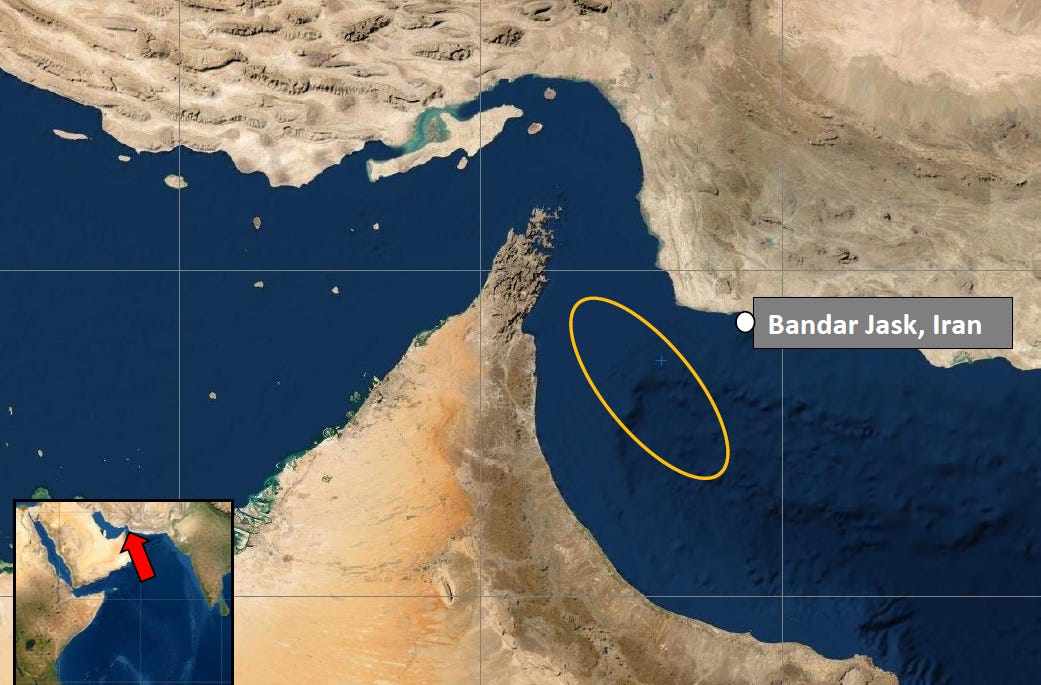
IRAN - On March 10, 2025, the United Kingdom Maritime Trade Operations (UKMTO) issued an Advisory Incident reporting significant GPS interference in the Strait of Hormuz near Bandar Jask, Iran.


According to the advisory, corroborated reports from vessel masters indicate that the disruptions, which lasted several hours, impacted electronic navigation systems, including GPS, AIS, and other Positioning, Navigation, and Timing (PNT) tools. The disruptions forced ships to switch to backup navigation methods to maintain safe passage through this critical maritime choke-point.
The incident, documented at 1830 UTC (6:30 PM UTC), underscores ongoing concerns about electronic interference in the region. Bandar Jask, strategically located east of the Strait of Hormuz, has previously been associated with Iranian activities, including the Islamic Revolutionary Guard Corps Navy (IRGCN) operations and potential GPS jamming capabilities.
The UKMTO has urged masters experiencing such disruptions within its Voluntary Reporting Area (VRA) to report incidents to its watch-keepers, highlighting the need for heightened vigilance.
This event aligns with historical patterns of GPS interference in the Persian Gulf and Strait of Hormuz, often linked to geopolitical tensions.
While the source of this specific interference remains unconfirmed, it echoes past reports of Iranian jamming efforts, such as incidents noted in recent years by the U.S. Maritime Administration, aimed at disrupting maritime and aviation navigation.
As the Strait of Hormuz remains vital for global oil and gas transit, such incidents pose significant risks to commercial shipping, prompting calls for robust contingency measures.