


4.7 Magnitude Earthquake Near Bandar Abbas Sparks Nuclear Test Speculation, But Tectonic Activity Likely Cause
Iran’s nuclear sites are not known to exceed 1 kilometer in depth.

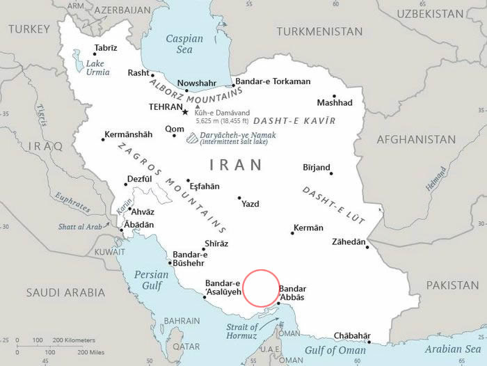
BANDAR ABBAS—According to the USGS, a 4.7-magnitude earthquake struck Iran 35 km (22 miles) northeast of Bandar-e Lengeh, near Bandar Abbas, at a depth of 6.2 miles (10 km), which is considered shallow, on March 9, 2025.


The shallow depth has prompted limited speculation about a possible nuclear test by Iran, given its advanced uranium enrichment, though 10 km exceeds the typical 0.1-1 km depth of most underground tests, which are engineered for containment and are more easily detectable by seismic networks. Iran’s nuclear sites are not known to exceed 1 kilometer in depth.
However, there is no concrete evidence to support this speculation. Iran insists its nuclear program is peaceful, and no nuclear tests have been confirmed, with U.S. intelligence assessments indicating Iran halted weaponization efforts in 2003, despite ongoing IAEA monitoring of its enrichment activities. The agency now states Iran has enough highly refined uranium to make multiple nuclear bombs.
The earthquake struck near Bandar Abbas, within the seismically active Makran subduction zone and southern Zagros Fold and Thrust Belt, where natural earthquakes are frequent, with hundreds occurring annually.
Nuclear tests are typically conducted in remote deserts or mountainous regions, such as Iran’s Dasht-e Kavir or Dasht-e Lut, to minimize detection and population risks, unlike the densely populated coastal area of Bandar Abbas.
Bandar Abbas is unsuitable for nuclear testing due to its population of over 500,000 and lack of specialized infrastructure, such as deep underground tunnels required to contain detonation blasts and monitor yields.
Additionally, Bandar Abbas’s location near the Persian Gulf’s international waters, heavily monitored by global satellites, naval forces, and seismic networks, makes it too exposed for a covert nuclear test.